


1. Introduction
In the face of escalating environmental challenges, the role of technology in advancing ecological sustainability has become increasingly critical. As urban areas continue to expand, the preservation of natural landscapes, particularly forests, demands innovative solutions that go beyond traditional forest protection methods.
1.1. Research Gap
In 2023, the Zhuhai Municipal Government introduced the "Zhuhai Municipal Land and Space Basic Information Platform (Intelligent Forest Chief and Forest Management) Operation Manual," which outlines the operation of the Intelligent Forest Chief and Forest Management Module. This platform aims to familiarize users with forest management systems and tools. Despite these advancements, the platform exhibits several limitations:
1) Limited Accessibility for Ordinary Citizens: Primarily government-oriented, these platforms are often difficult for the general public to use, which can diminish public engagement in forest conservation efforts.
2) Governance Challenges: The broad application of government platforms complicates the specific and timely addressing of issues like garbage disposal effectiveness, which could be better managed through localized detection and reporting by residents.
3) Limited Functionality and Coverage: Current platforms suffer from operational difficulties, low popularity and inadequate coverage of forest plant species, alongside a deficiency in the dissemination of forest protection knowledge.
1.2. Related Works
The integration of Artificial Intelligence (AI) and Machine Learning (ML) technologies in forest management and conservation is rapidly transforming ecological studies and practices. Shivaprakash et al. [1] explore the potential of AI and ML in biodiversity conservation, focusing on their application in managing forests and related services in India. They discuss the effectiveness of AI in enhancing the monitoring, management, and conservation of biodiversity and forest resources, highlighting the need for broader adoption and improved access to big data technologies. United Nation (UN) describe how AI can assist in protecting forest ecosystems, specifically through the development of early warning systems using satellite imagery [2]. These systems are crucial for local communities, especially in vast regions like the Amazon, to combat deforestation effectively and enforce environmental laws. In the realm of practical applications, another significant contribution is by Borz et al. [3], who investigate the use of close-range sensors combined with AI in forestry. Their study demonstrates how electronics and sensor-based technologies, when integrated with AI, can significantly improve the accuracy and efficiency of forest resource management. Furthermore, Astola et al. [4] focus on the use of deep neural networks with transfer learning for forest variable estimation. Their research utilizes Sentinel-2 imagery to estimate various forest parameters in boreal forests, showcasing how transfer learning can enhance the predictive accuracy of deep learning models in environmental applications. Similar studies have also been reported in [5-7].
These studies collectively underscore the transformative potential of AI and big data in forestry. They also point out the challenges and opportunities in adopting these technologies, paving the way for future research and application in forest protection.
1.3. System Objectives and Anticipated Impact
The development of ecological civilization is not only vital for its immediate benefits but also for the sustainability it brings to future generations. This study is designed utilizing the Spring Boot architecture, drawing upon software engineering development methods. It integrates VUE technology, artificial intelligence, and other cutting-edge technologies to enhance the intelligence and interactivity of the system. The aim is to furnish a scientific foundation and decision-making support that will bolster ecological civilization construction and forest protection efforts, thereby contributing to the sustainability of our environment and society.
2. Software Development
This section details the development and functional specifics of the "Smart Forest Protection" mini program, as outlined through comprehensive background analysis and system design.
2.1. Overall Demand Analysis
Following the background analysis, in order to solve the above problems, the internal process of the "Smart Forest Protection" mini program is shown in Figure 1.
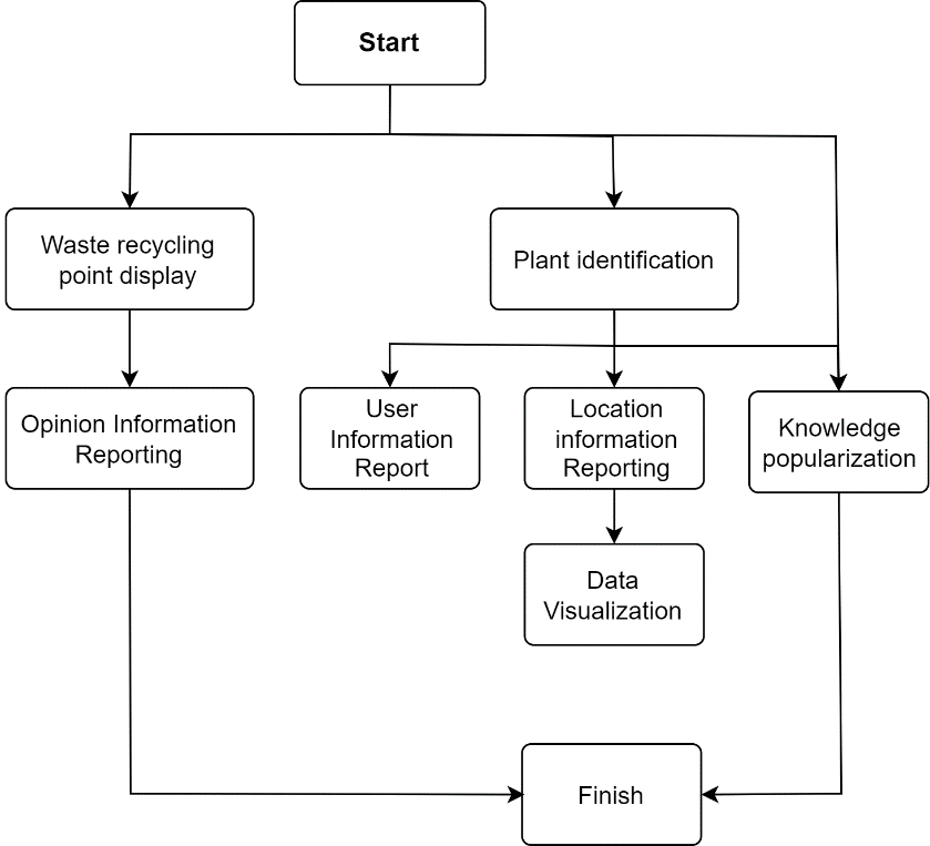
Figure 1. Internal system flowchart.
2.2. System Functional Requirements
According to the application positioning, the system users are divided into two categories: mini program users and relevant government departments. The system interaction based on these two types of users is depicted in Figure 2.
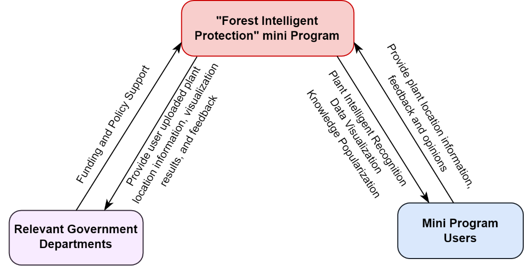
Figure 2. Illustration on system interaction.
The mini program is segmented into six functional modules, as illustrated in Figure 3:
1) Plant Intelligent Recognition Module: Users can scan images of plants or directly capture real plants by using their mobile devices. Thereafter, users can access detailed information about the plant, including its scientific name, distribution range, protection methods in the forest protection knowledge dissemination module based on the recognized plant name.
2) User Information Reporting Module: By employing big data analysis technology and intelligent image recognition technology, the information reporting function is achieved, allowing the positions of identified plants to be reported to the database.
3) Data Visualization Module: Develops a visual system leveraging big data analysis. The system achieves an intuitive display of various plant distribution areas by receiving plant location and scientific name data returned from the front-end.
4) Forest Protection Knowledge Module: Partners with the Zhuhai Forestry Bureau to integrate popular science knowledge from different fields such as forest plant protection, forest fire prevention and control, and forest waste disposal into mini programs.
5) Garbage Collection Point Display Module: Utilizes GIS technology to identify and display waste disposal points within forest areas, facilitating efficient waste management.
6) Feedback on Opinion Information Module: On the basis of the garbage collection point display module, a feedback module is further derived. This module allows users to discover and report real-time issues with garbage collection points, such as equipment damage, garbage overflow, and emergency situations such as forest fire hazards, by uploading images and text information.
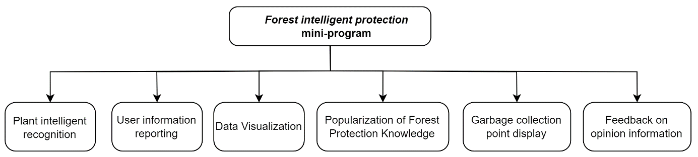
Figure 3. Functional module diagram.
2.3. Non-Functional Requirements
The system's non-functional requirements are analysed from four aspects: performance requirements, reliability requirements, usability requirements, and maintainability requirements. The details are explained as follows:
1) Performance Requirements: The system prioritizes efficient front-end and back-end interaction by employing image compression techniques, such as using the webp format and bilinear interpolation methods from the OpenCV library. This reduces image size without compromising quality. To minimize network latency, the system consolidates mini program requests, thereby reducing the number of HTTP requests. Additionally, file caching technology is implemented to lower the frequency of server requests, enhancing response times.
2) Reliability Requirements: To maintain data integrity, hash verification technology is employed, ensuring that data remains unaltered during transmission, storage, and processing. The system's robustness is further reinforced by integrated fault detection and recovery mechanisms capable of real-time issue identification. In the event of a fault, rapid recovery algorithms are activated, allowing for swift restoration of normal operations.
3) Usability Requirements: The user experience is at the forefront of system design, achieved through a flat design style and a clear layout that reduce visual clutter and highlight essential elements. Make this program easy to use.
4) Maintainability Requirements: The system's architecture adopts a modular and component-based design philosophy. By dividing the system into discrete functional modules and components, each with defined responsibilities and interfaces, the system achieves high internal cohesion and low coupling.
3. System Design
3.1. System framework design
The smart forest protection mini program adopts the Spring Boot architecture in C/S mode, which is divided into three layers: customer layer, service layer, and data layer. The system architecture of the three-layer structure of the Smart Forest Protection Mini Program is shown in Figure 4.
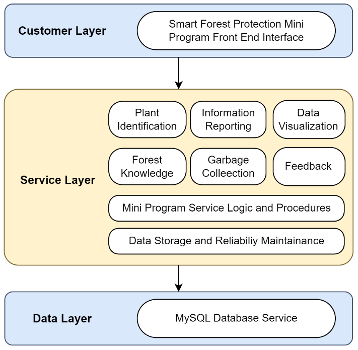
Figure 4. System framework design.
3.2. Database design
The database design of the smart forest protection mini program is mainly divided into six modules, namely user information, identification results, domestic plant endangered degree information table, garbage collection point information table, and user feedback information table. Design the above modules using MySQL, and the detailed design of each database is as follows.:
1) Human_data Table:
This table catalogues the user information, facilitating user interaction with the software. Key attributes include the User ID, Username, System Role, and Feedback ID number. The Human_data table's design, visualized in Figure 5, establishes the foundational user schema of the database and maintains a direct one-to-one relationship with the Result data table for streamlined data reference and retrieval.
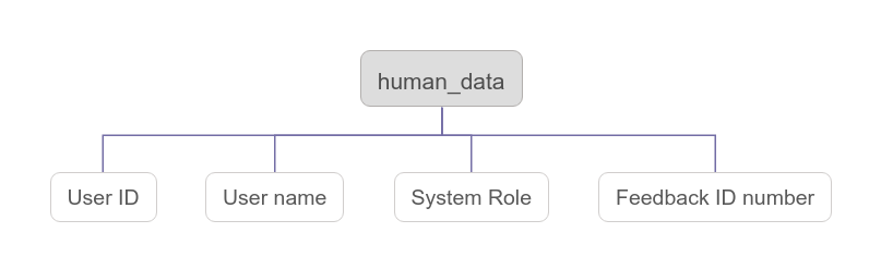
Figure 5. Human_data table structure
2) Result data Table:
Dedicated to capturing the outcomes of the plant identification feature, the Result data table stores key identification results. It records attributes such as the Result ID, Identification Data Results, Plant Name, and Result Storage Address, with the table's layout detailed in Figure 6.
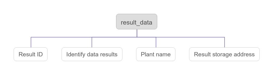
Figure 6. Result_data table structure.
3) All plants Table:
This table is an extensive catalogue of domestic plants, encompassing critical data for biodiversity conservation efforts. It holds details such as the Plant ID, Scientific Name, Chinese Name, the degree of Endangerment, and Protection Level. Illustrated in Figure 7, the All_plants table is structured to facilitate data-driven conservation measures and has a one-to-one linkage with the IUCN table, emphasizing the importance of plant protection status.
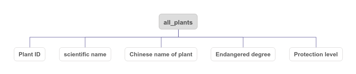
Figure 7. IUCN table structure.
4) IUCN Table:
This table is designed to reflect the endangerment levels of domestic plants, in line with the classifications established by the International Union for Conservation of Nature (IUCN). It serves to categorize plants according to their risk of extinction within China. Critical fields include Endangerment Degree, with Figure 8 set to detail the table's structure.
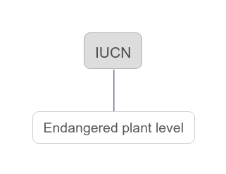
Figure 8. IUCN table structure.
5) Collection_point Table:
The Collection_point table is a repository of data on garbage collection points across Zhuhai City. This includes the Collection Point ID, Name, Address, and Type of waste collected, facilitating efficient waste management and supporting environmental protection initiatives. The layout of this table is demonstrated in Figure 9.
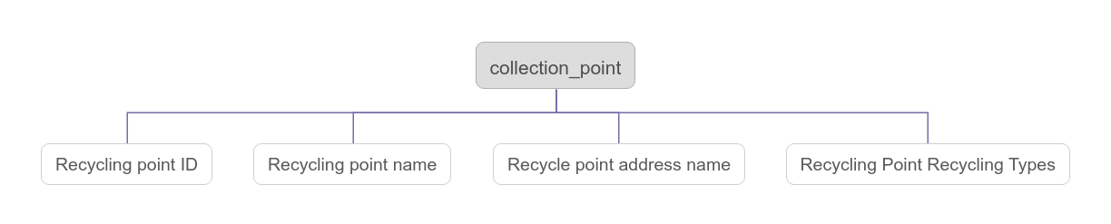
Figure 9. Collection_point structure.
6) Call_back Table:
The Call_back table captures user feedback, a vital component for continuous improvement of the mini program. It stores the Feedback ID, User ID, Username, and the content of feedback, ensuring that user insights contribute directly to system refinements. The structure of this table is outlined in Figure 10. Notably, there is a one-to-many relationship between the Call_back and Human_data tables, which allows for multiple feedback entries to be associated with a single user, capturing diverse interactions and user experiences within the mini program.
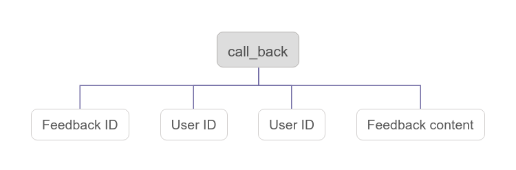
Figure 10. Call_back structure.
4. System Implementation
4.1. Data Crawling
Web crawler software is configured to search and retrieve plant images and related data from the internet, specifically targeting resource-rich websites. The PPBC official website is used as a primary source, where plant data is crawled, ensuring that images and accompanying information are comprehensive and sample-rich. The images, once downloaded and adequately formatted, are prepared for model training.
4.2. Function Implementation
1) Plant Intelligent Recognition
• Utilizing a dataset of 3253 samples across 30 plant species, the system processes images using the OpenCV library. Preprocessing includes bilinear difference scaling and image transformation to prepare data for the Convolutional Neural Network (CNN) model.
• The CNN model is structured with multiple convolutional layers and a multi-layer perceptron (MLP), incorporating dropout rates and activation functions tailored for plant classification.
• CNN model implementation: In the CNN model, there are four convolutional layers with sizes of (33,33,32), (33,33,32), (16,16,64), and (16,16,64), respectively. The first layer is the input layer, where 3 is the number of channels and 33 x 33 is the resolution of each channel. Compute convolutional layers using a 3x3 filter kernel with the same padding and ReLU activation function. Apply unfilled 2x2 max pooling between the second and third convolutional layers. Apply another 2x2 max pooling after the last convolutional layer to obtain a max pooling layer of size (8,8,64). Finally, a multi-layer perceptron (MLP) with a hidden layer is used to calculate the prediction probability of a specific feature belonging to the plant class. After obtaining the input layer of MLP by flattening the max pooling layer, the dropout rate between the input layer and the hidden layer, as well as between the hidden layer and the output layer of MLP, is set to 0.3. Use ReLU activation function between the input layer and hidden layer of MLP. Based on the hidden layer of MLP, use sigmoid activation function to predict the probability of specific features belonging to the plant class.
• Model optimization includes callbacks like ReduceLROnPlateau and Early Stopping to enhance performance, with a validation set accuracy of 91% and recall rate of 92.3%.
2) User Information Reporting
Post-identification reporting allows users to contribute plant data, such as nomenclature and conservation status, to the system, fostering a collaborative data-rich environment.
3) Data Visualization
Plant data from the Forestry Bureau and users are synthesized to illustrate distribution across a geographical interface, enhancing user engagement and providing a visual compendium of flora.
4) Forest Protection Knowledge Popularization
The system serves as an educational portal on forest conservation, offering detailed insights into various plant species and ongoing conservation efforts through interactive and informative content.
5) Garbage Collection Points Display
Users are provided with a mapped representation of recycling points, complete with type categorization and navigational support to promote eco-friendly waste disposal practices.
6) Feedback on Opinion Information
A feedback loop is established for users to report forest-related concerns and suggestions, bolstering the system's responsiveness and facilitating a community-driven approach to forest governance.
5. System Testing
To ensure the Smart Forest Protection mini program functions optimally, comprehensive multi-level testing was conducted on all system modules. The testing protocol was integral throughout the development process, affirming the system's stability and reliability for practical applications.
5.1. Unit Testing
• Leveraging the Spring Boot+Vue architecture, JUnit was selected for automated unit testing, allowing for thorough evaluation of individual units of source code along with associated control data, usage procedures, and operating procedures.
• To extend testing coverage across all system layers, the Postman tool was employed to assess the interfaces within the Controller, Service, and Dao layers.
• A meticulous testing plan, aligned with Spring Boot's three-tier architecture, was formulated and executed, guaranteeing each unit module's interfaces were rigorously evaluated and validated.
5.2. Performance Testing
• High concurrency scenarios were simulated using LoadRunner to evaluate the mini program's robustness, particularly focusing on the plant recognition feature's response to simultaneous user access.
• The homepage was subjected to concurrent access by groups of 50, 100, and 200 users to monitor performance impact.
• Results from these tests, as presented in Table 1, demonstrate the system's scalability with average response times and HTTP response rates per second indicating the system's capacity to handle increased user loads without significant performance degradation.
Table 1. Performance Test Results
Number of virtual concurrent users | 50 | 100 | 200 |
Average response time | 1.324 | 2.133 | 2.674 |
HTTP response rate per second | 35.798 | 34.263 | 33.736 |
6. Conclusion
The intelligent forest protection mini program, grounded in the robust Spring Boot framework and enhanced by deep learning algorithms, represents a significant advancement in the realm of ecological conservation technology. This system offers a suite of functionalities—ranging from the identification and geolocation of forest flora to the dissemination of forest conservation knowledge and the facilitation of waste management through garbage collection point localization. Moreover, it provides a platform for users to express their views on forest conservation efforts. By integrating these capabilities, the system plays a pivotal role in elevating public consciousness about forest stewardship and offers valuable data-driven insights and technical resources for the protection of urban forests. Through its application, it has the potential to contribute substantially to the ecological well-being of urban environments.
References
[1]. K. N. Shivaprakash et al., “Potential for Artificial Intelligence (AI) and Machine Learning (ML) Applications in Biodiversity Conservation, Managing Forests, and Related Services in India,” Sustainability, vol. 14, no. 12, Art. no. 12, Jan. 2022, doi: 10.3390/su14127154.
[2]. “Statistical Methods for Environment Field Trials, High-Dimensional Functional Data, and Image-Based High-Throughput Phenotyping - ProQuest.” Accessed: Apr. 14, 2024. [Online]. Available: https://www.proquest.com/openview/b61294bf19527a1acf37a0177c6be4e5/1.pdf?pq-origsite=gscholar&cbl=18750&diss=y#page=119
[3]. S. A. Borz, A. R. Proto, R. Keefe, and M. D. Niţă, “Electronics, Close-Range Sensors and Artificial Intelligence in Forestry,” Forests, vol. 13, no. 10, Art. no. 10, Oct. 2022, doi: 10.3390/f13101669.
[4]. H. Astola, L. Seitsonen, E. Halme, M. Molinier, and A. Lönnqvist, “Deep Neural Networks with Transfer Learning for Forest Variable Estimation Using Sentinel-2 Imagery in Boreal Forest,” Remote Sensing, vol. 13, no. 12, Art. no. 12, Jan. 2021, doi: 10.3390/rs13122392.
[5]. Y. Guo et al., “A Deep Fusion uNet for Mapping Forests at Tree Species Levels with Multi-Temporal High Spatial Resolution Satellite Imagery,” Remote Sensing, vol. 13, no. 18, Art. no. 18, Jan. 2021, doi: 10.3390/rs13183613.
[6]. “Application of Artificial Intelligence to Risk Analysis for Forested Ecosystems | SpringerLink.” Accessed: Apr. 14, 2024. [Online]. Available: https://link-springer-com.remotexs.ntu.edu.sg/chapter/10.1007/978-94-017-2905-5_3
[7]. B. Haq et al., “Tech-Driven Forest Conservation: Combating Deforestation With Internet of Things, Artificial Intelligence, and Remote Sensing,” IEEE Internet of Things Journal, pp. 1–1, 2024, doi: 10.1109/JIOT.2024.3378671.
Cite this article
Chen,Y.;Yu,J.;Yang,Y. (2024). Developing a smart forest protection mini program with Spring Boot: Integrating big data and image recognition technologies. Applied and Computational Engineering,77,63-71.
Data availability
The datasets used and/or analyzed during the current study will be available from the authors upon reasonable request.
Disclaimer/Publisher's Note
The statements, opinions and data contained in all publications are solely those of the individual author(s) and contributor(s) and not of EWA Publishing and/or the editor(s). EWA Publishing and/or the editor(s) disclaim responsibility for any injury to people or property resulting from any ideas, methods, instructions or products referred to in the content.
About volume
Volume title: Proceedings of the 2nd International Conference on Software Engineering and Machine Learning
© 2024 by the author(s). Licensee EWA Publishing, Oxford, UK. This article is an open access article distributed under the terms and
conditions of the Creative Commons Attribution (CC BY) license. Authors who
publish this series agree to the following terms:
1. Authors retain copyright and grant the series right of first publication with the work simultaneously licensed under a Creative Commons
Attribution License that allows others to share the work with an acknowledgment of the work's authorship and initial publication in this
series.
2. Authors are able to enter into separate, additional contractual arrangements for the non-exclusive distribution of the series's published
version of the work (e.g., post it to an institutional repository or publish it in a book), with an acknowledgment of its initial
publication in this series.
3. Authors are permitted and encouraged to post their work online (e.g., in institutional repositories or on their website) prior to and
during the submission process, as it can lead to productive exchanges, as well as earlier and greater citation of published work (See
Open access policy for details).
References
[1]. K. N. Shivaprakash et al., “Potential for Artificial Intelligence (AI) and Machine Learning (ML) Applications in Biodiversity Conservation, Managing Forests, and Related Services in India,” Sustainability, vol. 14, no. 12, Art. no. 12, Jan. 2022, doi: 10.3390/su14127154.
[2]. “Statistical Methods for Environment Field Trials, High-Dimensional Functional Data, and Image-Based High-Throughput Phenotyping - ProQuest.” Accessed: Apr. 14, 2024. [Online]. Available: https://www.proquest.com/openview/b61294bf19527a1acf37a0177c6be4e5/1.pdf?pq-origsite=gscholar&cbl=18750&diss=y#page=119
[3]. S. A. Borz, A. R. Proto, R. Keefe, and M. D. Niţă, “Electronics, Close-Range Sensors and Artificial Intelligence in Forestry,” Forests, vol. 13, no. 10, Art. no. 10, Oct. 2022, doi: 10.3390/f13101669.
[4]. H. Astola, L. Seitsonen, E. Halme, M. Molinier, and A. Lönnqvist, “Deep Neural Networks with Transfer Learning for Forest Variable Estimation Using Sentinel-2 Imagery in Boreal Forest,” Remote Sensing, vol. 13, no. 12, Art. no. 12, Jan. 2021, doi: 10.3390/rs13122392.
[5]. Y. Guo et al., “A Deep Fusion uNet for Mapping Forests at Tree Species Levels with Multi-Temporal High Spatial Resolution Satellite Imagery,” Remote Sensing, vol. 13, no. 18, Art. no. 18, Jan. 2021, doi: 10.3390/rs13183613.
[6]. “Application of Artificial Intelligence to Risk Analysis for Forested Ecosystems | SpringerLink.” Accessed: Apr. 14, 2024. [Online]. Available: https://link-springer-com.remotexs.ntu.edu.sg/chapter/10.1007/978-94-017-2905-5_3
[7]. B. Haq et al., “Tech-Driven Forest Conservation: Combating Deforestation With Internet of Things, Artificial Intelligence, and Remote Sensing,” IEEE Internet of Things Journal, pp. 1–1, 2024, doi: 10.1109/JIOT.2024.3378671.