


1. Introduction
Synthetic Aperture Radar (SAR) is an important remote sensing technology that plays a significant role in target imaging and recognition, as shown in Figure 1. It can achieve fine imaging and recognition of ground targets, unaffected by light, weather and other conditions, and has the ability to image all-weather. Traditional SAR imaging methods are mainly based on frequency-domain algorithms, such as strip mode, scan mode, and beam mode. There is a certain contradiction between the imaging resolution and mapping bandwidth of these methods, and it is difficult to meet the needs of high resolution and wide mapping at the same time. In order to overcome this limitation, High Resolution Wide Swath (HRWS) SAR imaging technology has emerged. HRWS SAR can obtain azimuth high-resolution and wide swath SAR data at the same time, which brings new opportunities and challenges to SAR target imaging and recognition.
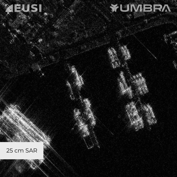
Figure 1. An example of Synthetic Aperture Radar (SAR). (25 cm SAR image from Umbra) [1].
In addition to HRWS SAR, other imaging technologies such as multi-polarimetric SAR and holographic imaging have also been gradually applied to target imaging and recognition. Multi-polarimetric SAR can provide more abundant scattering information, which helps to improve the accuracy of target recognition. Holographic imaging can achieve more accurate imaging and can be used for target recognition and target tracking.
However, SAR target imaging and recognition still face some challenges. For example, complex marine background environment, azimuth ambiguity, side-lobe ambiguity and other factors will affect the performance of target detection. In addition, the difficulty of target feature extraction and classification and recognition in SAR images is also great, which needs further research and improvement.
The main content of this paper is to discuss the research progress of SAR technology in target imaging and recognition. Chapter 2 reviews and discusses the related reviews. Although there are some related reviews at present, they are not comprehensive enough for the application of SAR technology in target imaging and recognition. Therefore, chapter 3 mainly discusses SAR target imaging technology, chapter 4 mainly discusses SAR target recognition technology. Finally, the current technical challenges and future directions are discussed in chapter 5. Chapter 6 is the conclusion.
2. Review and Discussion of Related Reviews
At present, there are some review articles on SAR, such as [2-4], which have reviewed SAR image processing, covering target detection, target recognition, image registration and other aspects. Existing literatures have emphasized the important role of deep learning technology in SAR image processing and analyzed the performance of various deep learning models and algorithms [5-6]. In addition, three articles have also discussed the challenges and future development directions in SAR image processing, such as data scarcity, class imbalance, real-time performance, and interpretability [8-10]. A summary of existing surveys is listed in Table 1.
Table 1. A summary of existing surveys.
Existing Survey | Summary | Advantages | Shortcomings |
[1] | The article provides a comprehensive overview of SAR image processing, covering various aspects such as target detection, target recognition, and image registration. | The article provides a detailed introduction to deep learning methods, especially the e-network and its variants, and discusses their application in SAR optical registration. | Although the article mentions GAN and semantic segmentation methods, it lacks in-depth discussion on these emerging technologies. |
[2] | The article provides a comprehensive overview of traditional and deep learning methods for SAR target recognition, including non-CNN models and CNN models, as well as methods for solving the problem of limited samples. | The article introduces commonly used SAR target recognition datasets and evaluation indicators, such as MSTAR, OpenSARShip, OpenSARUrban, and precision, recall, F1 score, etc. | Lack of in-depth discussion on the latest research trends. |
[3] | The article provides a comprehensive overview of SAR image analysis techniques based on deep learning, including target detection and target recognition, as well as different CNN architectures and parameter settings. | The article conducts an in-depth analysis of different target detection and target recognition methods, including methods based on SSD and CFAR, as well as methods based on CNN, and discusses their advantages and disadvantages. | The article provides a brief overview of different deep learning models, but the comparison and analysis between them are limited. |
3. SAR Target Imaging Technology
SAR (Synthetic Aperture Radar) target imaging technology has made significant progress in recent years, providing a powerful observation means for the remote sensing field. This section reviews the latest research trends of SAR target imaging technology, focusing on the innovative achievements in imaging algorithms, imaging quality improvement, target feature extraction and recognition, and compares them with the old methods about 14 years ago, analyzing the advantages and disadvantages of each.
3.1. Current SAR target imaging technologies
Current SAR target imaging technologies mainly include multi-static SAR systems, terahertz SAR systems, 3D-ISAR systems, and SAR systems based on deep learning technology, as shown in Table 2.
Table 2. Different types of SAR systems.
Type | Description |
Multi-static SAR system | Utilizes multiple transmitters and receivers to obtain data simultaneously to achieve more accurate imaging and monitoring. |
Terahertz SAR system | Utilizes the high resolution and penetration ability of the terahertz band to achieve more accurate imaging and target recognition. |
3D-ISAR system | Utilizes 3D point cloud information to achieve more accurate target recognition and classification. |
Deep learning technology | Utilizes deep learning technology for image enhancement. |
3.2. Review and analysis of the latest progress
Meng X et al. proposed a polarization formatting algorithm (PFA) imaging processing system based on multi-core digital signal processor (DSP) for processing high squint angle airborne SAR data [11]. The system uses pulse compression and PFA algorithm for imaging processing, and uses adaptive focusing technology for phase error compensation. The system realizes high-speed imaging processing on multi-core DSP, and can generate 2K*2K images to meet the requirements of real-time processing.
Yonel B et al. proposed a phase-less SAR imaging technology based on multi-static configuration and incoherent waveform, using Wirtinger Flow (WF) algorithm for image reconstruction [12]. The technology uses multiple transmitters and a single receiver, and generates forward mapping of approximate Gaussian by random waveform. WF algorithm can process the deviation between forward mapping and Gaussian distribution, and realize approximate image reconstruction.
Villano M et al. explored the potential of multi-static SAR system in Earth observation and demonstrated it using drone swarms. Multi-static SAR system can obtain all data required to form a digital elevation model (DEM) and high-resolution mapping at the same time [13]. Drone swarms can be used to test multi-static concepts and obtain mapping data with sub-hour time resolution.
Tian H et al. combined airborne cross-track array SAR technology and sparse flight sampling method, and proposed an effective image reconstruction algorithm based on compressed sensing (CS) to improve the 3D image quality of airborne array SAR downward observation [14]. The algorithm compresses the SAR signal spectrum to a narrowband by interferometric measurement technology, and then uses CS theory for sparse reconstruction. The effectiveness of the algorithm has been proven in simulation experiments.
Pui C Y et al. proposed a 3D-ISAR target classification scheme based on convolutional neural network (CNN), using the density map of target 3D point cloud as input features [15]. The scheme uses point cloud density map (PDI) as features and uses CNN for target classification. The scheme has been tested on simulation data and real data, and its effectiveness has been proven.
Ren H et al. analyzed the spatial correlation characteristics of medium orbit/missile-carried bistatic SAR systems, laying the foundation for the imaging algorithm of the system [16]. The research established an accurate geometric model of MEO/missile-carried bistatic SAR and analyzed the phase characteristics under high squint angle and large scenes. The study analyzed the spatial variance characteristics of MEO/missile-carried bistatic SAR and pointed out that the azimuth variance is the main spatial variance.
3.3. Comparison and Summary of the Latest Progress with the Old Technology Methods
The old method proposed in has the advantages of requiring only a single SAR image, being suitable for new high-resolution SAR sensors, and being able to process different building shapes and perspectives [17]. The old method proposed in has the advantages of being able to measure the average deformation speed of scatterers and extract time series to monitor nonlinear deformation [18]. These two old literatures have broadened the horizons for subsequent research. However, the former has the disadvantage of lower accuracy in height estimation for low-resolution SAR data, and the latter has the disadvantage of higher computational complexity and the need for appropriate thresholds to determine scatterers for low-noise data. In contrast, the latest technologies can achieve 360° omnidirectional observation imaging and obtain more comprehensive and abundant azimuth scattering information. The deep learning method represented by can process target images under different perspectives with high classification accuracy and computational efficiency [15]. If we can continue to explore and apply technologies such as deep learning, we may even be able to continue to improve resolution while reducing computational time by improving computational efficiency.
4. SAR Target Recognition Technology
SAR target recognition technology, as one of the key technologies in the field of radar imaging, has made significant progress in recent years. This section reviews the latest research results in the field of SAR target imaging and recognition, focusing on SAR target recognition technology and elaborating on algorithm innovation and data processing, comparing them with the old methods 15 years ago and analyzing the advantages and disadvantages of each.
Currently, deep learning is widely used in SAR target recognition applications, including using deep learning technology for image enhancement to improve image quality and facilitate subsequent processing and analysis, using deep learning technology for target recognition to improve recognition accuracy and efficiency, and using knowledge distillation technology to transfer the knowledge of complex networks to lightweight networks to realize the deployment of SAR target recognition algorithms on edge platforms.
4.1. Review and Analysis of the Latest Progress
Alpala R J et al. developed a test statistic based on bootstrap-improved non-parametric entropy estimation to identify deviations from the fully developed speckle hypothesis in intensity SAR data [19]. This method uses a non-parametric entropy estimator to evaluate the deviation from the fully developed speckle hypothesis in intensity SAR data.
Liu L et al. proposed an inshore ship detection method based on deep neural networks for SAR images [20]. This method proposes a land-sea segmentation method based on multi-scale fully convolutional networks (MS-FCN) and a target detection method based on rotatable bounding boxes (DR-Box) to solve the problem of inshore ship detection.
4.2. Comparison and Summary of the Latest Progress with the Old Technology Methods
The old technology method proposed in the literature [21] has demonstrated advantages such as high recognition accuracy, strong robustness, and no need for motion correction, providing reference and ideas for the progress of the latest technology. However, compared with the traditional majority voting method (Boyer-Moore Algorithm), the algorithm complexity of the fractional fusion method is higher and requires more computing power. The latest technology widely uses machine learning. Once the machine learning model is trained, it can complete image parsing tasks in a very short time, which is crucial for time-sensitive SAR application scenarios (such as disaster response). In addition, with the progress of algorithms and computing power, machine learning models can be continuously optimized, and performance can be continuously improved.
5. Future Challenges and Directions
5.1. Challenges
The first challenge is computational efficiency: The computational efficiency of rapid SAR imaging algorithms is still a challenge and requires further research and development of more efficient algorithms, such as parallel computing on new hardware platforms (such as high-performance GPUs). The second challenge is adversarial attack defense: CNN-based target recognition methods are vulnerable to adversarial attacks. The third challenge is data acquisition and processing: The acquisition of HRWS SAR and polarimetric SAR data requires more complex systems and technologies, and more effective data processing methods need to be studied, such as data compression and denoising techniques. The fourth challenge is featuring extraction and classification recognition: The difficulty of target feature extraction and classification recognition in SAR images is relatively large, and further research and improvement are needed, such as continuing to study feature extraction and classification recognition methods based on deep learning, and studying feature extraction and classification recognition methods based on multi-source data fusion. The fifth challenge is adaptability to application scenarios: Some imaging technologies and recognition algorithms have limitations in their application scenarios and need to be selected and adjusted according to specific needs, such as studying customized imaging and recognition algorithms for different application scenarios.
5.2. Future Directions
The first research direction is integrated, multi-mode SAR imaging and recognition: Develop SAR imaging systems that can simultaneously obtain high-resolution and wide swath SAR data, as well as SAR target recognition technology based on deep learning. The second research direction is multi-source data fusion: fuse SAR data with other remote sensing data (such as optical images and LiDAR data) to gain a more comprehensive understanding of targets and the environment. The third research direction is adversarial attack defense: CNN-based target recognition methods are vulnerable to adversarial attacks, especially many existing attack methods can attack without prior knowledge of the target model’s categories and parameters. Corresponding adversarial methods include Gradient Masking and Gradient Confusion. Gradient Masking adds noise or perturbations to the model, making it difficult for attackers to accurately obtain model gradient information and reducing the success rate of attacks. Gradient Confusion adds confusing terms to the model, making it difficult for attackers to distinguish between the real gradients and confusing terms of the model, thus reducing the success rate of attacks.
6. Technical Problems and Inferences
6.1. Technical Problems
• SAR data requires complex signal processing to generate high-resolution images. This includes tasks like motion compensation, speckle filtering, and focusing algorithms.
• There's always a push to improve the resolution of SAR images, which can be limited by factors such as the wavelength of the radar signal and the size of the antenna.
• The atmosphere can introduce errors into SAR imagery, such as attenuation, refraction, and multipath effects.
• SAR systems generate large volumes of data, which can be challenging to store, transmit, and process efficiently.
• For airborne or spaceborne SAR, maintaining the stability of the platform is crucial for obtaining high-quality images.
6.2. Inferences
• SAR can infer surface characteristics like roughness, moisture content, and type of material due to its sensitivity to the backscattering coefficient.
• SAR data is often used to infer changes in the environment, such as deforestation, urban expansion, and natural disasters.
• SAR can penetrate clouds and provide data on wind speed and direction over the ocean, which is valuable for weather prediction models.
• In the military context, SAR can be used to detect and classify targets based on their radar cross-section and other signatures.
7. Conclusion
Synthetic Aperture Radar (SAR) technology has made significant progress in the field of target imaging and recognition. In terms of imaging technology, it has developed from traditional strip mode, scan mode, and spotlight mode to High Resolution Wide Swath (HRWS) SAR, polarimetric SAR, terahertz SAR, 3D-ISAR, and others, which can obtain more accurate and comprehensive target information. Deep learning technology has demonstrated strong capabilities in SAR image classification, target detection, feature extraction, and other aspects, significantly improving recognition accuracy and efficiency. In addition, multi-source data fusion technology integrates SAR data with other remote sensing data, such as optical images and LiDAR data, to gain a more comprehensive understanding of targets and the environment, improving the reliability of target recognition.
In the future, SAR technology development will move towards the direction of integrated, multi-mode imaging. SAR imaging systems that can simultaneously obtain high-resolution and wide swath data will be developed, combined with deep learning technology for target recognition to achieve higher efficiency and accuracy. At the same time, artificial intelligence and machine learning technologies will play a greater role in SAR target imaging and recognition, such as target tracking based on reinforcement learning and model robustness improvement based on adversarial training. In addition, multi-source data fusion technology will continue to develop, integrating SAR data with other remote sensing data to gain a more comprehensive understanding of targets and the environment, improving the reliability of target recognition [22, 23].
References
[1]. Zuzana Hajkova What is SAR Imagery? Introduction to Synthetic Aperture Radar[OL], https://www.euspaceimaging.com/blog/2024/04/05/what-is-sar-imagery/, 5 April, 2024
[2]. Sommervold O, Gazzea M, Arghandeh R. A survey on SAR and optical satellite image registration[J]. Remote Sensing, 2023, 15(3): 850.
[3]. Li J, Yu Z, Yu L, et al. A comprehensive survey on SAR ATR in deep-learning era[J]. Remote Sensing, 2023, 15(5): 1454.
[4]. Passah A, Sur S N, Abraham A, et al. Synthetic Aperture Radar image analysis based on deep learning: A review of a decade of research[J]. Engineering Applications of Artificial Intelligence, 2023, 123: 106305.
[5]. Jiang W, Han H, Zhang Y, et al. Federated split learning for sequential data in satellite–terrestrial integrated networks[J]. Information Fusion, 2024, 103: 102141.
[6]. Yang B, Wang X, Xing Y, et al. Modality Fusion Vision Transformer for Hyperspectral and LiDAR Data Collaborative Classification[J]. IEEE Journal of Selected Topics in Applied Earth Observations and Remote Sensing, 2024.
[7]. Jiang W, Zhan Y, Xiao X. Multi-domain network slicing in satellite–terrestrial integrated networks: A multi-sided ascending-price auction approach[J]. Aerospace, 2023, 10(10): 830.
[8]. Jianping W, Guangqiu Q, Chunming W, et al. Federated learning for network attack detection using attention-based graph neural networks[J]. Scientific Reports, 2024, 14(1): 19088.
[9]. Jiang W. Cellular traffic prediction with machine learning: A survey[J]. Expert Systems with Applications, 2022, 201: 117163.
[10]. Jiang W. Graph-based deep learning for communication networks: A survey[J]. Computer Communications, 2022, 185: 40-54.
[11]. Meng X, Zhu D, Dong L. Highly Squinted Airborne SAR Imaging Based on Multi-Core DSP System[C]//2021 IEEE 6th International Conference on Signal and Image Processing (ICSIP). IEEE, 2021: 361-365.
[12]. Yonel B, Choudhury N, Yazici B. Phaseless Multi-Static Synthetic Aperture Radar Imaging[J]. IEEE Journal of Selected Topics in Applied Earth Observations and Remote Sensing, 2024.
[13]. Villano M, Peixoto M N, Kim S, et al. Potential of Multi-Static SAR Systems for Earth Monitoring and Their Demonstration Using Swarms of Drones[C]//IGARSS 2023-2023 IEEE International Geoscience and Remote Sensing Symposium. IEEE, 2023: 4586-4589.
[14]. Tian H, Li D. Sparse flight array SAR downward-looking 3-D imaging based on compressed sensing[J]. IEEE Geoscience and Remote Sensing Letters, 2016, 13(10): 1395-1399.
[15]. Pui C Y, Ng B, Rosenberg L, et al. Target classification for 3D-ISAR using CNNs[J]. IEEE Transactions on Aerospace and Electronic Systems, 2023, 60(1): 94-105.
[16]. Ren H, Zhang Y, Li G, et al. The Characteristic Analysis of Spatial Variance of MEO/Missile-Borne Bistatic SAR[C]//IGARSS 2023-2023 IEEE International Geoscience and Remote Sensing Symposium. IEEE, 2023: 8142-8145.
[17]. Brunner D, Lemoine G, Bruzzone L, et al. Building height retrieval from VHR SAR imagery based on an iterative simulation and matching technique[J]. IEEE Transactions on Geoscience and Remote Sensing, 2009, 48(3): 1487-1504.
[18]. Fornaro G, Reale D, Serafino F. Four-dimensional SAR imaging for height estimation and monitoring of single and double scatterers[J]. IEEE Transactions on Geoscience and Remote Sensing, 2008, 47(1): 224-237.
[19]. Liu L, Chen G, Pan Z, et al. Inshore ship detection in SAR images based on deep neural networks[C]//IGARSS 2018-2018 IEEE International Geoscience and Remote Sensing Symposium. IEEE, 2018: 25-28.
[20]. Wong S K. High range resolution profiles as motion-invariant features for moving ground targets identification in SAR-based automatic target recognition[J]. IEEE Transactions on Aerospace and Electronic Systems, 2009, 45(3): 1017-1039.
[21]. Xuanshen WAN, Wei LIU, Chaoyang NIU, et al. Black-box Attack Algorithm for SAR-ATR Deep Neural Networks Based on MI-FGSM[J]. Journal of Radars, 2024, 13: 1-16.
[22]. He M, Jiang W, Gu W. TriChronoNet: Advancing electricity price prediction with Multi-module fusion[J]. Applied Energy, 2024, 371: 123626.
[23]. Jiang W, Zhang Y, Han H, et al. Mobile traffic prediction in consumer applications: a multimodal deep learning approach[J]. IEEE Transactions on Consumer Electronics, 2024.
Cite this article
Guo,J. (2024). The Latest Development of Synthetic Aperture Radar: An Overview. Applied and Computational Engineering,112,186-193.
Data availability
The datasets used and/or analyzed during the current study will be available from the authors upon reasonable request.
Disclaimer/Publisher's Note
The statements, opinions and data contained in all publications are solely those of the individual author(s) and contributor(s) and not of EWA Publishing and/or the editor(s). EWA Publishing and/or the editor(s) disclaim responsibility for any injury to people or property resulting from any ideas, methods, instructions or products referred to in the content.
About volume
Volume title: Proceedings of the 5th International Conference on Signal Processing and Machine Learning
© 2024 by the author(s). Licensee EWA Publishing, Oxford, UK. This article is an open access article distributed under the terms and
conditions of the Creative Commons Attribution (CC BY) license. Authors who
publish this series agree to the following terms:
1. Authors retain copyright and grant the series right of first publication with the work simultaneously licensed under a Creative Commons
Attribution License that allows others to share the work with an acknowledgment of the work's authorship and initial publication in this
series.
2. Authors are able to enter into separate, additional contractual arrangements for the non-exclusive distribution of the series's published
version of the work (e.g., post it to an institutional repository or publish it in a book), with an acknowledgment of its initial
publication in this series.
3. Authors are permitted and encouraged to post their work online (e.g., in institutional repositories or on their website) prior to and
during the submission process, as it can lead to productive exchanges, as well as earlier and greater citation of published work (See
Open access policy for details).
References
[1]. Zuzana Hajkova What is SAR Imagery? Introduction to Synthetic Aperture Radar[OL], https://www.euspaceimaging.com/blog/2024/04/05/what-is-sar-imagery/, 5 April, 2024
[2]. Sommervold O, Gazzea M, Arghandeh R. A survey on SAR and optical satellite image registration[J]. Remote Sensing, 2023, 15(3): 850.
[3]. Li J, Yu Z, Yu L, et al. A comprehensive survey on SAR ATR in deep-learning era[J]. Remote Sensing, 2023, 15(5): 1454.
[4]. Passah A, Sur S N, Abraham A, et al. Synthetic Aperture Radar image analysis based on deep learning: A review of a decade of research[J]. Engineering Applications of Artificial Intelligence, 2023, 123: 106305.
[5]. Jiang W, Han H, Zhang Y, et al. Federated split learning for sequential data in satellite–terrestrial integrated networks[J]. Information Fusion, 2024, 103: 102141.
[6]. Yang B, Wang X, Xing Y, et al. Modality Fusion Vision Transformer for Hyperspectral and LiDAR Data Collaborative Classification[J]. IEEE Journal of Selected Topics in Applied Earth Observations and Remote Sensing, 2024.
[7]. Jiang W, Zhan Y, Xiao X. Multi-domain network slicing in satellite–terrestrial integrated networks: A multi-sided ascending-price auction approach[J]. Aerospace, 2023, 10(10): 830.
[8]. Jianping W, Guangqiu Q, Chunming W, et al. Federated learning for network attack detection using attention-based graph neural networks[J]. Scientific Reports, 2024, 14(1): 19088.
[9]. Jiang W. Cellular traffic prediction with machine learning: A survey[J]. Expert Systems with Applications, 2022, 201: 117163.
[10]. Jiang W. Graph-based deep learning for communication networks: A survey[J]. Computer Communications, 2022, 185: 40-54.
[11]. Meng X, Zhu D, Dong L. Highly Squinted Airborne SAR Imaging Based on Multi-Core DSP System[C]//2021 IEEE 6th International Conference on Signal and Image Processing (ICSIP). IEEE, 2021: 361-365.
[12]. Yonel B, Choudhury N, Yazici B. Phaseless Multi-Static Synthetic Aperture Radar Imaging[J]. IEEE Journal of Selected Topics in Applied Earth Observations and Remote Sensing, 2024.
[13]. Villano M, Peixoto M N, Kim S, et al. Potential of Multi-Static SAR Systems for Earth Monitoring and Their Demonstration Using Swarms of Drones[C]//IGARSS 2023-2023 IEEE International Geoscience and Remote Sensing Symposium. IEEE, 2023: 4586-4589.
[14]. Tian H, Li D. Sparse flight array SAR downward-looking 3-D imaging based on compressed sensing[J]. IEEE Geoscience and Remote Sensing Letters, 2016, 13(10): 1395-1399.
[15]. Pui C Y, Ng B, Rosenberg L, et al. Target classification for 3D-ISAR using CNNs[J]. IEEE Transactions on Aerospace and Electronic Systems, 2023, 60(1): 94-105.
[16]. Ren H, Zhang Y, Li G, et al. The Characteristic Analysis of Spatial Variance of MEO/Missile-Borne Bistatic SAR[C]//IGARSS 2023-2023 IEEE International Geoscience and Remote Sensing Symposium. IEEE, 2023: 8142-8145.
[17]. Brunner D, Lemoine G, Bruzzone L, et al. Building height retrieval from VHR SAR imagery based on an iterative simulation and matching technique[J]. IEEE Transactions on Geoscience and Remote Sensing, 2009, 48(3): 1487-1504.
[18]. Fornaro G, Reale D, Serafino F. Four-dimensional SAR imaging for height estimation and monitoring of single and double scatterers[J]. IEEE Transactions on Geoscience and Remote Sensing, 2008, 47(1): 224-237.
[19]. Liu L, Chen G, Pan Z, et al. Inshore ship detection in SAR images based on deep neural networks[C]//IGARSS 2018-2018 IEEE International Geoscience and Remote Sensing Symposium. IEEE, 2018: 25-28.
[20]. Wong S K. High range resolution profiles as motion-invariant features for moving ground targets identification in SAR-based automatic target recognition[J]. IEEE Transactions on Aerospace and Electronic Systems, 2009, 45(3): 1017-1039.
[21]. Xuanshen WAN, Wei LIU, Chaoyang NIU, et al. Black-box Attack Algorithm for SAR-ATR Deep Neural Networks Based on MI-FGSM[J]. Journal of Radars, 2024, 13: 1-16.
[22]. He M, Jiang W, Gu W. TriChronoNet: Advancing electricity price prediction with Multi-module fusion[J]. Applied Energy, 2024, 371: 123626.
[23]. Jiang W, Zhang Y, Han H, et al. Mobile traffic prediction in consumer applications: a multimodal deep learning approach[J]. IEEE Transactions on Consumer Electronics, 2024.